Runoff Estimation for Suggested Water Harvesting Sites in the Northern Jordanian Badia ()
1. Introduction
Historically, arid lands have not invested in hydrological data acquisition such as flood volumes and rates, rainfall intensities and volumes, etc. Hydrological data collection such as rainfall intensities and flood volumes started in Jordan not long ago and it is concentrated in the humid parts of the country. In the last few years, the Badia started to receive more attention in documenting natural resources. This was as a result of the high population pressure in the limited urbanized areas of the country and the need to utilize the Badia for future development. Daily and annual rainfall recorders were installed on a very limited scale over the Badia. Flood volumes were not recorded in the Badia areas except in very few cases where limited time records were taken in small areas for specific projects [1].
Jordan is a developing country situated off the southeastern shores of the Mediterranean Sea between longitudes 35˚ and 39˚ East and latitudes 29˚ and 33˚ North (Figure 1). It is bounded in the North by Syria, in the East by Iraq and Saudi Arabia, in the South by Saudi Arabia and in the West by the River Jordan and the Dead Sea. Its area is about 90,000 km2 and consists of various distinctive topographic units trending in a north-south direction. These units are the rift valley, high lands and the arid lands-desert region.
Jordan is characterized by severe weather conditions, therefore great temporal and spatial variations in rainfall; runoff and evaporation amounts are expected [2]. Water harvesting has been practiced in Jordan throughout history for both irrigation and household purposes [3,4].
Reference [5] conducted a research on site selection criteria for rain water harvesting systems in the Jordanian Badia based on the integration between indigenous knowledge and the use of Geo-informatics. This research was based on the fact that water resources in Jordan are very limited and the country needs an intensive work to come up with more water resources to cover the sharp increase in water consumption for all sectors. A total of 200 stakeholders were invited from within the local communities in the Badia to provide the research team with some constrains that from their point of views are vital in choosing the suitable sites for water harvesting in their region. Also, they pointed out to certain locations within the Badia that could be utilized as a water har-

Figure 1. Location map of Jordan and general topography (in meters).
vesting sites based on their knowledge of the area as livestock owners. 30 sites in the Jordanian Badia were found to be suitable for water harvesting based on GIS analysis and local communities recommendations. Part of the project is conducting a geophysical and soil investigation for five potential sites selected by the project in order to determine their suitability for water harvesting.
This research aims to use GIS for investigating the potential of having enough runoff in the selected site to establish water harvesting dams based on the rainfall, evaporation data and catchments' areas for the selected sites. The application of GIS for catchemnt area analysis have been addressed in the literature in many researches (e.g. [6-10]).
2. Methods
2.1. Investigated Area
The study area is located in the northeastern Badia, which receives more rain on average than the other parts of the Badia. The annual rainfall varies from over 150 mm in the northwest to less than 50 mm in the southeast with an average of 70 - 80 mm. Rainfall as thunderstorms, characterized by irregular intensity and duration, forms the greatest part of total precipitation in the area. Rainfall occurs mostly during winter months (October to April) with the highest intensities in the months December to February. The annual mean temperature is 15˚C with a mean monthly range of 8˚C - 28˚C, January to July. Evaporation rates are in general very high, with an average daily potential evaporation range of 3 - 17 mm/day, January to July [11].
The basaltic rocks cover 11,000 km2 of the northeastern Badia. Gentle slopes and relatively flat topography characterize the surface. The surface elevation is mostly 600 - 1100 m above sea level; highest in the northeast (Figure 2). Geological variation is reflected in the geomorphology; faults have developed into Wadis but the sub-surface rocks made the development of channel networks very limited except in some parts where the weathering rates are high. Large boulders are distributed in the north and east of the area where the younger basalt is found. On the other hand, smaller rocks are found in the western part of the Badia where older basalt and higher rainfall helps weathering. The poor channel network results in blockages across most of the water courses in the Badia. These blockages create natural pools in the depressions where most of the runoff ends and evaporates leaving salty fine soil. The depressions (qa’a) are widely distributed in the Badia and form a major part of the surface geomorphology. Another type of depression (marab) is formed in the course of major channels. The marabs are formed from blockages that are not substantial enough to create pools but which impeed runoff which has led to soil accumulation. Flood water that does not infiltrate into the soil finds its way out of the marab. This process results in renewing the marab soil; only the coarse soil
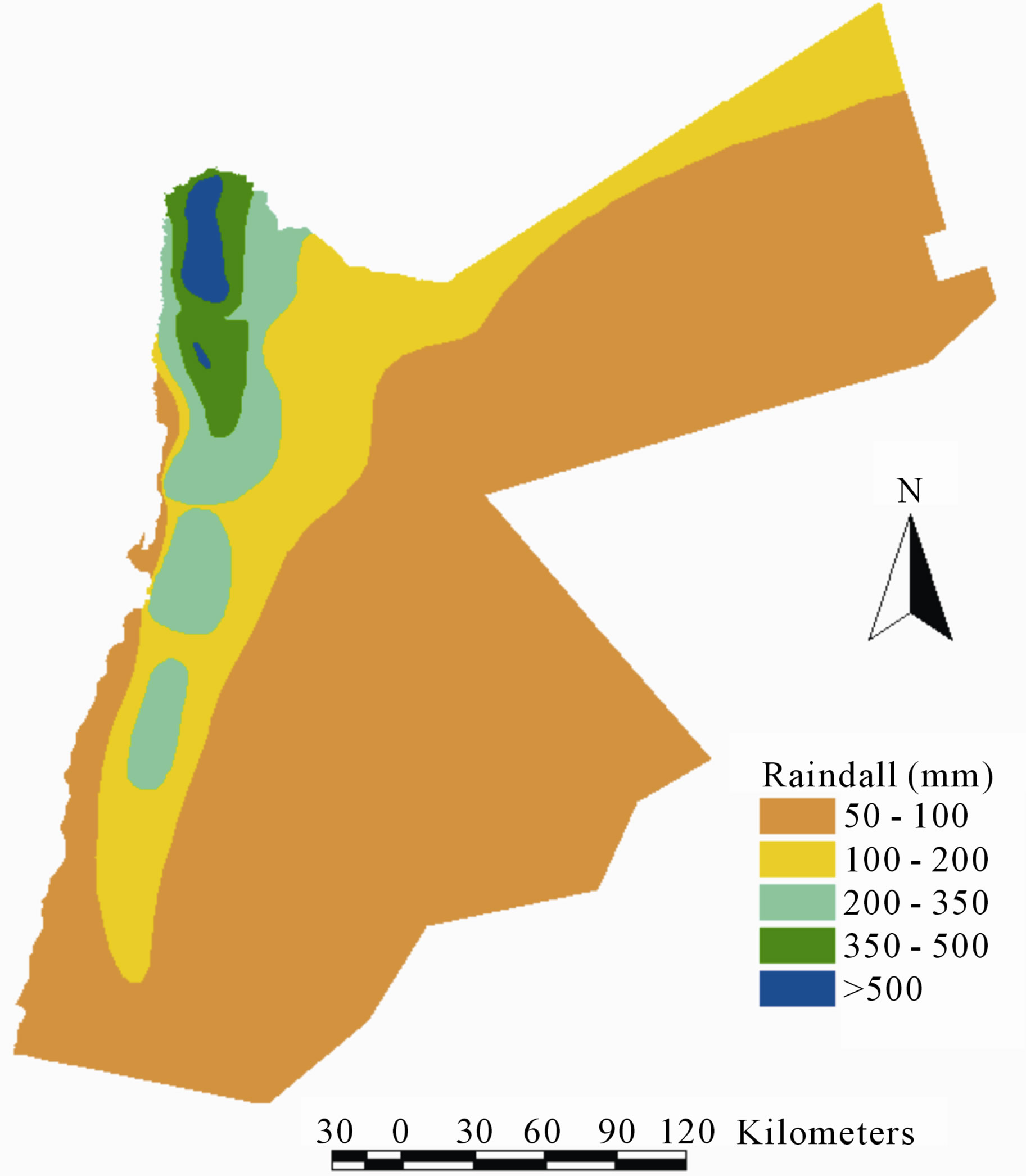
Figure 2. Jordan rainfall isohyets map [12].
particles have the chance to settle, resulting in good productive soil for range land vegetation and some seasonal crops such as barley and wheat. The parent soil material and the climatic parameters control the soil types and properties. In the northeast Badia, the soil is derived from basaltic lava and its development influenced by topography and weathering. Most of the soils are of depositional origin, which is dominant for arid lands. On steep slopes with high erosion residual soils occur on the rocks. Soils include well developed xerochrepts in the areas of older basalt flows and high weathering effect, and weakly developed xerothents on the more recent basalt flow [1].
2.2. Data Collection
Table 1 lists the secondary data sets that have been obtained from different government agencies in Jordan and from previous research in order to achieve the main objectives of this research. Also the average rainfall data for Jordan (Figure 2) is used to find the average rainfall for each catchment.